View Larger (PDF)
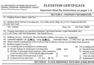
A FEMA elevation certificate (sometimes called a Flood Certificate) is a tool provided by the National Flood Insurance Program (NFIP) to determine the likelihood of your house being damaged in a flood. It is a technical document which must be prepared by a registered land surveyor. It documents the elevation of your house in relation to the elevation published on the Flood Insurance Rate Map.
This information is then used by your insurance agent to determine whether or not a property owner needs to obtain flood insurance on his or her property and what the insurance premium will be.
How Does The Surveyor Create A FEMA Flood Elevation Certificate?
View Larger (PDF)
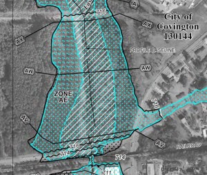
To complete an Elevation Certificate, the surveyor must first locate the property on the appropriate Flood Insurance Rate Map. The rate maps for a community generally show the base flood elevations and the flood zones. The surveyor will determine the flood elevation for your house.
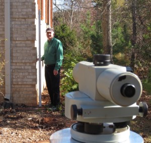
Next, the land surveyor will use GPS or run levels from a bench mark having a known elevation to your house and establish a temporary bench mark on your property. The surveyor then gathers elevation information for your house which includes the elevations of each floor, the highest and lowest natural elevations of the ground at your house, and the lowest elevation of a deck or steps which attach to your house, and other required elevations. The surveyor will take pictures of the four sides of your house. Then, the surveyor compiles this elevation data in the Elevation Certificate.
This information will then be used by your insurance agent to determine whether or not the property owner needs to have flood insurance and how much it will cost. Generally, the higher the house is above the flood elevation, the lower the insurance premium will be for that house. It is the prerogative of the lender to require flood insurance even if your house is not in a flood zone. If this is the case you will probably qualify for a preferred risk policy which will have very low rates.
Flood Insurance Rate Maps are updated from time to time, and the flood elevation for a house may change over time based on local land use and on the technology that is used to plot the flood limits. Oftentimes, people may be paying for flood insurance based on old rate maps. It may benefit you to have a professional land surveyor verify that your FEMA Elevation Certificate is based on the most current Flood Insurance Rate Maps.
Do I Need A FEMA Elevation Certificate?
Lenders will often require flood insurance when a refinance occurs, or when your loan is otherwise due for a review. The lender wants to protect their investment and will insist that you purchase flood insurance. They will purchase it for you, but it is usually cheaper if you contact your own insurance agent for a premium quote.
If you are selling your home it pays to be proactive and provide a FEMA Elevation Certificate to the prospective buyer as an inducement to purchase your home. If there is a slight risk of flooding the buyer can choose to obtain a quote before making an offer on the house.
Likewise, if you are buying a house, make it a condition of the contract that a FEMA Elevation Certificate be provided and that, if required, insurance can be obtained that does not exceed a certain amount.
How Much Does A FEMA Elevation Certificate Cost?
The most important factors affecting the cost of a FEMA Elevation Certificate are as follows:
- The number of structures on the property that need to be insured. Each structure must have a separate FEMA Elevation Certificate.
- The size and complexity of the structure.
- The ability to obtain GPS readings under heavy tree canopy around the house.
If you would like a price quote, just fill out our survey quote request form, and we’ll get back to you as soon as possible.

